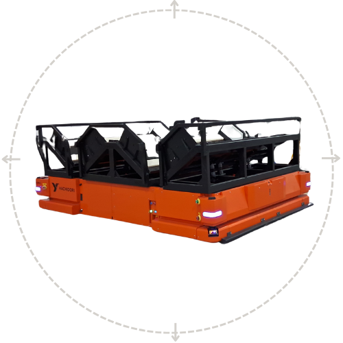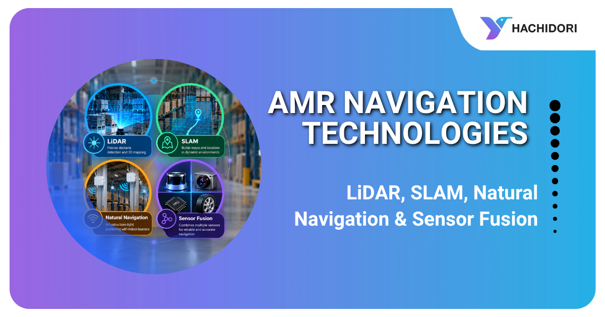
Autonomous Mobile Robots (AMRs) are transforming material movement in factories and warehouses by reducing dependence on manual trolleys, forklifts, and fixed-path automated guided vehicles (AGVs). However, selecting the right AMR requires more than evaluating payload capacity and operating speed. Understanding the navigation technologies behind these robots is essential for ensuring safe, reliable, and efficient operations.
For warehouse managers, manufacturing leaders, and logistics decision-makers, technologies such as LiDAR, SLAM, natural navigation, and sensor fusion play a critical role in determining an AMR’s performance in real-world industrial environments.
As an experienced AMR Manufacturer, Hachidori Robotics develops autonomous material movement solutions designed for dynamic industrial environments. Its navigation technologies, including Wireless Natural Navigation (WiNN) and indoor positioning systems, help businesses automate intralogistics operations without relying on conventional floor markers or fixed travel paths.
Whether you are evaluating an industrial mobile robots solution for your warehouse or comparing options from a Mobile Robot Manufacturer, understanding these navigation technologies will help you make a more informed investment.
What Is AMR Navigation?
AMR navigation refers to the technologies and algorithms that enable an autonomous mobile robot to determine its location, understand its surroundings, select an appropriate route, and move safely toward its destination.
Unlike traditional AGVs that typically follow predefined paths using magnetic tape, wires, or other guidance markers, AMRs can navigate dynamically through changing industrial environments.
An AMR navigation system generally includes:
- Localization: Determines the robot’s position and orientation.
- Mapping and perception: Builds an understanding of the facility and identifies obstacles.
- Path planning: Calculates efficient routes between destinations.
- Motion control: Controls the robot’s movement along its planned route.
- Obstacle avoidance: Detects obstacles and adjusts movement when necessary.
- Fleet management: Coordinates tasks and routes when multiple robots operate together.
- System integration: Connects robot missions with warehouse management systems (WMS), manufacturing execution systems (MES), and enterprise resource planning (ERP) platforms.
These capabilities directly influence operational throughput, workplace safety, layout flexibility, and return on investment (ROI).
When choosing an AMR Manufacturer, businesses should therefore evaluate the complete navigation architecture rather than focusing on an individual sensor or technology.
How Do AMRs Navigate Warehouses and Factories?
AMRs use a combination of sensors, positioning technologies, and navigation algorithms to move materials between workstations, storage areas, production lines, and dispatch zones.
A typical navigation process involves five steps.
-
Environmental sensing
LiDAR scanners measure distances to surrounding objects, while depth cameras capture additional information about obstacles and the environment. Other sensors may provide movement, orientation, or positioning data.
-
Localization and mapping
The robot estimates its current position using technologies such as SLAM, Wireless Natural Navigation, or other indoor positioning methods.
-
Path planning
The navigation software calculates a suitable route while considering aisle restrictions, obstacles, traffic conditions, and destination requirements.
-
Movement and safety monitoring
The AMR Robots follows the planned route while continuously monitoring its surroundings. If a person, forklift, or pallet obstructs its path, the robot can slow down, stop, or replan its route according to its configured safety and navigation logic.
- Continuous adaptation
Advanced systems can accommodate operational changes through map updates, route adjustments, or configuration changes. The amount of work required depends on the navigation technology and the nature of the layout change.
For businesses investing in Industrial Automation Mobile Robots, this combination of sensing, positioning, and control is essential for reliable material movement in busy manufacturing and warehousing environments.
What Is LiDAR Navigation?
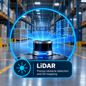
LiDAR stands for Light Detection and Ranging. It uses laser measurements to determine the distance between the robot and surrounding objects, helping the AMR understand the geometry of its environment.
How LiDAR Navigation Works
A LiDAR scanner emits laser pulses and measures the reflected signals. These measurements generate spatial data that can represent walls, racks, pallets, machinery, and other objects.
The robot uses this information for:
- Detecting obstacles in its path.
- Identifying walls and aisle boundaries.
- Supporting localization and mapping algorithms.
- Aligning with docking stations, conveyors, and workstations.
- Supporting configured protective fields and safety responses when used with appropriate safety-rated equipment.
Benefits of LiDAR Navigation
- Accurate environmental perception: Provides detailed distance measurements.
- Reduced dependence on lighting: Laser-based sensing can operate in many lighting conditions where conventional cameras may be less effective.
- Rapid obstacle detection: Helps the robot respond to objects entering its path.
- Industrial suitability: Supports navigation in warehouses and production facilities with structured layouts.
Limitations of LiDAR
LiDAR alone does not necessarily determine the robot’s global position on a facility map. Additional localization algorithms, reference information, or positioning technologies may be required.
Reflective surfaces, glass, dust, and certain environmental conditions can also affect measurement quality. Complex environments may require complementary sensors.
For an AMR Manufacturer, LiDAR is an important component of the navigation and perception system, but its effectiveness depends on how it is integrated with localization, path planning, and safety functions.
What Is SLAM in AMRs?
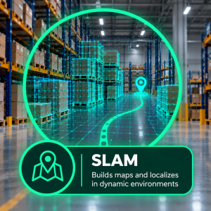
SLAM stands for Simultaneous Localization and Mapping. It allows a robot to build or update a map of its surroundings while estimating its own position within that map.
SLAM navigation is widely used in autonomous mobile robot systems because it reduces dependence on extensive fixed-path infrastructure.
How SLAM Navigation Works
As the AMR moves through a facility, it collects data from sensors such as LiDAR, cameras, and inertial measurement units (IMUs).
The SLAM algorithm processes these observations to create a map and estimate the robot’s position and orientation. Depending on the implementation, it can also correct accumulated positioning errors as new environmental information becomes available.
Benefits of SLAM Navigation
- Reduces the need for magnetic tape, wires, or predefined physical paths.
- Supports flexible material movement across warehouses and factories.
- Helps accommodate changes to operational routes and work areas.
- Enables navigation in existing facilities as well as newly constructed sites.
- Supports autonomous movement across multiple workstations and storage zones.
Limitations of SLAM
SLAM performance can be affected by repetitive environments, limited environmental features, dynamic obstacles, and rapid changes to the surroundings.
Some implementations may require map updates, validation, or additional positioning technologies to maintain reliable performance.
For businesses comparing an AMR Manufacturer or Mobile Robot Manufacturer, it is important to understand how the vendor’s SLAM implementation performs in the actual operating environment.
What Is Wireless Natural Navigation in AMRs?
 Wirelesss Natural Navigation enables AMRs to navigate using environmental features or positioning references instead of relying exclusively on artificial floor markers, magnetic tracks, or ceiling-mounted QR codes.
The exact implementation varies by manufacturer. Some systems use naturally occurring environmental features, while others combine wireless positioning references with onboard sensors.
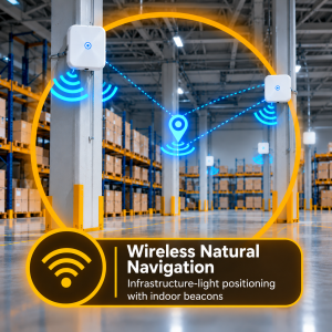
Hachidori Robotics offers Wireless Natural Navigation (WiNN), its patented navigation technology, alongside indoor positioning capabilities for industrial material movement applications.
How Natural Navigation Works
Depending on the system architecture, the robot may use:
- Environmental features detected by onboard sensors.
- Wireless positioning references or indoor beacons.
- LiDAR and camera data for environmental perception.
- Navigation algorithms that combine positioning and sensor information.
These inputs help the robot estimate its position and navigate toward assigned destinations.
It is important to distinguish between natural-feature-based navigation and beacon-assisted positioning. They are related approaches to infrastructure-light navigation, but they do not operate identically. The installation requirements and positioning performance depend on the particular system.
Benefits of Natural Navigation
- Reduces reliance on conventional fixed-path guidance.
- Supports flexible material movement across changing operational areas.
- Can reduce the disruption associated with changing routes.
- Helps businesses adapt automation to evolving warehouse and factory layouts.
- Supports scalable intralogistics automation when appropriately designed.
Limitations of Natural Navigation
The system’s performance depends on its positioning method, environmental conditions, and implementation quality. Beacon-assisted systems may require wireless infrastructure, while natural-feature-based systems may depend on the availability of identifiable environmental features.
For this reason, businesses should ask vendors about installation requirements, positioning accuracy, interference management, and the process for handling layout changes.
Natural navigation is particularly relevant for companies seeking Industrial Mobile Robots that can support flexible workflows without extensive floor modifications.
What Is Sensor Fusion in Robotics?
Sensor fusion is the process of combining data from multiple sensors to develop a more reliable understanding of the robot’s position and surroundings.
Instead of relying on a single source of information, the navigation system combines complementary inputs to improve localization, perception, and motion control.
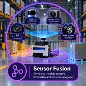
Sensors Commonly Used in AMR Sensor Fusion
An advanced AMR navigation architecture may combine:
- 2D LiDAR: Measures distances across a horizontal scanning plane.
- 3D depth cameras: Capture information about the height and shape of objects.
- IMUs: Measure acceleration and rotational movement.
- Wheel encoders: Estimate movement based on wheel rotation.
- Wireless positioning systems: Provide additional localization information where supported.
- Safety sensors: Detect hazards and initiate configured protective responses.
How Sensor Fusion Works
Each sensor has strengths and limitations. LiDAR provides distance measurements, cameras offer visual or depth information, IMUs track motion, and wheel encoders estimate movement.
The navigation software combines these inputs to estimate the robot’s position and interpret its surroundings. Depending on the architecture, sensor fusion can reduce the impact of individual sensor errors and improve overall navigation consistency.
Benefits of Sensor Fusion
- More robust localization when individual sensor readings become unreliable.
- Improved environmental awareness.
- Better support for obstacle detection and avoidance.
- More consistent navigation in complex industrial settings.
- Greater flexibility when integrating different positioning and perception technologies.
Limitations of Sensor Fusion
Sensor fusion increases system complexity and requires careful calibration, algorithm development, and validation. It also introduces additional hardware and software considerations.
Importantly, sensor fusion alone does not guarantee safety. Protective functions must be designed and validated using appropriate safety-rated components and standards.
For a Mobile Robot Manufacturer, combining sensors effectively is a key engineering challenge. The goal is to deliver a navigation system that performs consistently under the conditions found in real warehouses and production facilities.
LiDAR vs SLAM vs Natural Navigation vs Sensor Fusion
These technologies perform different functions and are often used together rather than as competing alternatives.
| Technology | Primary function | Main advantage | Key consideration |
| LiDAR navigation | Environmental perception and distance measurement | Detailed obstacle detection | Needs localization and planning capabilities for complete navigation |
| SLAM navigation | Mapping and self-localization | Reduces dependence on fixed paths | Performance depends on environmental features and algorithm quality |
| Wireless Natural Navigation | Navigation using environmental features or positioning references | Supports flexible, infrastructure-light operation | Requirements vary by implementation |
| Sensor fusion | Combines data from multiple sensors | Improves robustness and consistency | Requires careful integration and validation |
A well-designed AMR navigation system can combine these technologies to address different requirements. LiDAR supports perception, SLAM provides mapping and localization, natural navigation can provide additional positioning capabilities, and sensor fusion combines the available information.
The precise combination depends on the robot’s design, the operating environment, and the intended application.
Which AMR Navigation Technology Is Best for Your Warehouse?
There is no single navigation technology that is ideal for every facility. The right choice depends on operational requirements, environmental conditions, safety needs, and future expansion plans.
1. Evaluate Layout Flexibility
If your warehouse frequently changes its storage locations, production stations, or material flow, prioritize navigation systems that support flexible route management and efficient map updates.
2. Consider Safety and Human-Robot Interaction
Facilities with frequent pedestrian and forklift movement require appropriate obstacle detection, protective functions, validated stopping behavior, and effective traffic management.
Ask vendors to demonstrate how their robots respond to realistic scenarios rather than relying solely on demonstrations in controlled environments.
3. Assess Payload and Docking Requirements
Heavy loads, narrow aisles, and precise docking requirements demand careful evaluation of localization accuracy, braking performance, mechanical design, and docking repeatability.
The complete robot configuration matters, not just the navigation sensor.
4. Plan for Fleet Expansion
If you expect to deploy multiple robots, evaluate fleet management, traffic coordination, charging strategies, mission scheduling, and integration with existing operational systems.
5. Calculate Long-Term ROI
Consider installation costs, commissioning time, maintenance, infrastructure requirements, downtime, throughput improvements, and the cost of adapting the system when operations change.
A capable AMR Manufacturer should be able to explain how its solution addresses these factors and provide evidence from relevant applications.
How to Choose the Right AMR Manufacturer
Selecting the right Industrial Mobile Robot Manufacturer involves evaluating the complete automation solution, including navigation technology, hardware, software, safety, and support.
Use the following checklist when comparing vendors.
Environment compatibility: Can the AMR operate reliably in your lighting conditions, aisle widths, traffic patterns, and floor conditions?
Navigation architecture: Does the solution use LiDAR, SLAM, Wireless Natural Navigation (WiNN), sensor fusion, or another approach suited to your facility?
Positioning accuracy: What accuracy and repeatability can the vendor demonstrate under representative operating conditions?
Safety validation: Which safety standards and certifications apply to the specific robot and its protective functions?
Layout flexibility: What happens when racks, machinery, or production stations move? Does the change require remapping, recalibration, or additional infrastructure?
System integration: Can the AMR connect with your WMS, MES, ERP, conveyors, and production workflows?
Deployment experience: Does the vendor have relevant experience in manufacturing, automotive, warehousing, electronics, FMCG, or pharmaceutical environments?
Service and scalability: What commissioning, maintenance, training, spare-parts, and fleet-expansion support is available?
These questions help decision-makers compare Industrial Automation Mobile Robots based on operational performance rather than specifications alone.
Hachidori Robotics: Navigation for Dynamic Industrial Environments
Hachidori Robotics develops autonomous mobile robots for intralogistics material movement in industrial environments. Its solutions are designed to support material transportation across manufacturing facilities, warehouses, and other industrial operations.
The company’s navigation approach includes patented Wireless Natural Navigation (WiNN) technology and indoor positioning capabilities, alongside sensing and autonomous navigation technologies.
For businesses exploring AMR automation, the key evaluation criteria remain practical: how well the robot navigates the facility, handles obstacles, integrates with existing workflows, and adapts to operational changes.
By evaluating these factors through a site assessment and application-specific demonstration, businesses can determine whether a solution meets their material movement requirements.
To explore Hachidori Robotics’ solutions, visit the Autonomous Mobile Robots and Industries page.
Conclusion
AMR navigation technologies are fundamental to safe, flexible, and efficient industrial automation. LiDAR enables environmental perception, SLAM supports mapping and localization, Wireless Natural Navigation offers alternatives to conventional fixed-path guidance, and sensor fusion combines complementary sensor inputs for more robust performance.
For warehouse managers, manufacturing leaders, and logistics decision-makers, understanding these technologies makes it easier to select an AMR navigation system that fits real operating conditions and long-term business objectives.
When comparing an AMR Manufacturer or Mobile Robots Manufacturer, evaluate the complete navigation architecture, safety validation, integration capabilities, and total cost of ownership. The right Industrial Mobile Robots solution should do more than move materials from one location to another. It should help improve workflow efficiency, support changing operational requirements, and deliver measurable value over time.